
- Account
-
- NEW ARRIVALS
- Men
-

Core Climbing Apparel from prAna
Shop Now »
- Women
-

Patagonia Offers Versatility and Comfort for all your Adventures
Browse Patagonia »
- Kids
- Gear
- Snow Sports
-
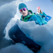
Stay Safe in the Backcountry
Shop Ortovox»
- Paddle Sports
-

Santa Knows How to Enjoy His Off-Season
Shop Red Paddle »
- DEALS
Also included are short descriptions of the ten best walks and day hikes along the Icefields Parkway—from the short stroll to Peyto Lake Viewpoint to the rewarding hike through alpine meadows to Helen Lake.
To make it easier to plan your day, we've also provided information about campgrounds, lodges, visitor centres and other key services along the Icefields Parkway. A mileage chart, area map and elevation profile complete the map.
Icefields Parkway Map Coverage
The Icefields Parkway Map covers the entire length of the Icefields Parkway, a 232-kilometre (144-mile) route between the village of Lake Louise and the town of Jasper. The route traverses some of the world’s most spectacular mountain scenery and is a highlight of any trip to the Canadian Rockies.
For ease of use, we have divided the Icefields Parkway into two sections: on one side of the map is the southern section between Lake Louise and the Columbia Icefield, while the reverse side highlights the section between the Columbia Icefield and the town of Jasper.
The Icefields Parkway Map shows all viewpoints, picnic areas, trailheads, campgrounds, hostels, lodges and other services along the Icefields Parkway, while the descriptions in the guide point you to the best of these - the best viewpoints of mountains and lakes, the most interesting points of interest and exhibits, and the best bets for spotting wildlife such as moose, bighorn sheep and mountain goats.
Also included are short descriptions of the ten best walks and day hikes along the Icefields Parkway—from the short stroll to Peyto Lake Viewpoint to the rewarding hike through alpine meadows to Helen Lake.
To make it easier to plan your day, we've also provided information about campgrounds, lodges, visitor centres and other key services along the Icefields Parkway. A mileage chart, area map and elevation profile complete the map.
Icefields Parkway Map Coverage
The Icefields Parkway Map covers the entire length of the Icefields Parkway, a 232-kilometre (144-mile) route between the village of Lake Louise and the town of Jasper. The route traverses some of the world’s most spectacular mountain scenery and is a highlight of any trip to the Canadian Rockies.
For ease of use, we have divided the Icefields Parkway into two sections: on one side of the map is the southern section between Lake Louise and the Columbia Icefield, while the reverse side highlights the section between the Columbia Icefield and the town of Jasper.
* ISBN: 978-1-895526-97-4
* Scale: 1:400,000
* Edition: 4th, 2020
* Folded size: 4 x 9 in
* Flat size: 18 x 24 in
The Icefields Parkway Map includes:
* Contour lines at 25-metre (80-foot) intervals
* Relief shading to better show the topography
* Full colour on both sides
* Hiking trails
* Hydrology – rivers, rapids, glaciers, and waterfalls
* Mountain names and all available mountain elevations
* All campgrounds
* Points of interest and attractions
* Picnic areas
* Highway viewpoints
How Adventure Bucks Work
Earn Adventure Bucks every time you make a purchase*! Even 'on sale' items, in-store or online at VPO.ca. Each Adventure Buck is worth $1, so figure out what you want to buy!
You can redeem your Adventure Bucks at anytime:
- InStore: Ask the staff to apply your Bucks to your purchase.
- Online: Enter the amount of Bucks you wish to redeem in the Payment tab to apply them to your online order.
- *Arc'teryx items are excluded
Shipping Information
We Ship Anywhere Within Canada
Signature Required & Faster Shipping Options
All parcels are shipped ground with a signature required. If you want your order quicker, give us a call at 1-800-SHOP-VPO for a quote. Prices are in Canadian dollars. We will ship your order via Purolator Ground or Canada Post Regular Parcel . If you prefer one method over another, please make note in the notes/delivery instructions when you checkout.
Free Shipping
FREE shipping on orders totaling $49 or more before taxes.
NOTICE: THIS ITEM WILL BE DELAYED BY 5-12 BUSINESS DAYS.
| Destination | Estimated Arrival |
| Western Canada | 5-15 business days |
| Central Canada | 7-17 business days |
| Eastern Canada | 9-21 business days |
* We use Purolator for majority of our shipments. If you live in a rural area, Northern Canada, the Maritimes, or we have to use Canada Post for delivery, please note that the estimated arrival time may be longer.
Oversized or Overweight Item
This item is subject to a shipping surcharge
Unfortunately due to the size or weight of this item, we are required to apply a shipping surcharge when you order this item. To read our full shipping and freight policy, please click here.
Sorry, the real-time inventory lookup is not available at this time.
Sorry, the colour and size you selected is not available.
Colour & size selection available at: